Title : Mt. Superior & Monte Cristo Peak
link : Mt. Superior & Monte Cristo Peak
Mt. Superior & Monte Cristo Peak
Drive up Little Cottonwood Cayon for 8 miles (past the Park in Ride, at the intersection), and park at the "Our Lady of the Snows Center" on your left (see photo below).
Distance: 2.7 miles (one way to Monte Cristo Peak)
Elevation gain: 2,500 ft
Time: 3-5 hours
Dog friendly? No, dogs aren't allowed in LCC
Kid friendly? No
Fees/Permits? None
The trail starts by walking up the paved road right by the Our Lady of the Snows Center, and take the first right. You'll then walk by the Sheriff's Station on your left, as the road rounds the corner.
Walking by the Sheriff's Station.
The road will turn West, and turn into a dirt road.
The dirt road turn East again. You'll follow the power lines most of the hike, until you reach Cardiff Pass.
Just after the road turns East, look for the trail splitting off to the left. This is your trail.
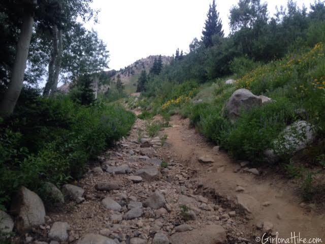
It's an old mining road, that is not really a road anymore, but a hiking trail.
As you continue up the trail to Cardiff Pass, you'll have amazing views of Snowbird to your left.
Working our way up the switchbacks. You'll see a few short cut trails, but I just followed the old road.
July is prime time to see the wildflowers at this elevation. These flowers looked so pretty, and the view of the Pfeifferhorn in the distance was awesome.
You'll come to a distinct trail split. To get to Cardiff Pass go left. If you have time and want to get a closer look at the Cardiff Mine, go right.
We continued left on the trail split, and the trail became a little steeper for this section. The flowers were a great distraction from the steep climb.
You now have a clear view of Cardiff Pass! Don't be fooled by the peak to the left - that isn't Mt. Superior - it's Christmas Tree Peak, and is called so, because in winter there are Christmas lights turned on, and are formed to look like a tree. Hike through the small meadow, and follow the trail until you reach the pass.
Once at Cardiff Pass, turn left (West) and follow this covered electrical line up this rocky area. Don't take the trail that curves around the South side of Christmas Tree Peak!
The trail was very steep for about 100 yards. We decided to skip bagging Christmas Tree Peak on the way to Mt. Superior - we figured if we had enough time on the way back we would stop by it.
The first full view of Mt. Superior - it's so close yet so far away!
On the North side (your right), you'll get amazing views into Big Cottonwood Canyon area, and Kessler Peak. This drainage you look into is where Doughnut Falls is, but a few miles down.
The trail is well defined along this section of the ridge up to Mt. Superior. No scrambling yet!
Now you can see the trail gets really steep and there's more rocks. Starting here, be very careful where you step and keep an eye out for cairns hikers have placed. The higher you stay on the trail, the closer to the ridgeline you'll be. If you drop down, it's much harder to climb back up and you'll get yourself into loose, gravel. Not fun!
A few sections require some easy climbing up to the ridge. Give your friends below some room, in case you accidentally kick rocks down to them. Another tip - keep everything in your pack, not your pockets. Phones, cameras, etc can easily fall out.
Only a little bit more of scrambling left!
Climbing on the knife edge, looking down into Big Cottonwood Canyon.
On the summit of Mt. Superior!
Signing the peak register, located in the mailbox. Look for my name!
While you are on the ridge, you might as well hike another 15 minutes to bag Monte Cristo Peak! It looks much further and more intimidating than it really is. I thought this ridge was easier than the climb up to Mt. Superior.
Dave got this photo of me on the last stretch to Monte Cristo - I love boulder hopping! The peak to the right is the famous Dromedary Peak (another peak on my list of hikes to do!)
Panorama with Monte Cristo on the left, Dromedary Peak just beyond Monte Cristo, and furthest away, Broad's Fork Twin Peaks.
My hiking buddy, Dave and I, on Monte Cristo!
#Selfie!
On this hike I am wearing "Psychedelic Punch" from FitnessFox Headbands (one of my favs!)
My snack choice for this hike - thick sliced bacon strips cooked up the night before. Salt, fat, and protein - YUM!
Taking in the view from Monte Cristo Peak, looking across to the south ridge of Little Cottonwood Canyon.
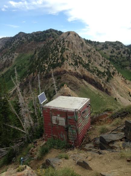
On the hike back, we had enough time to bag Christmas Tree Peak! This structure is to house electrical stuff.
A close up of the trail map, from the TH.
Trail map looking North.
Like this post? PIN & SHARE!
Thus articles Mt. Superior & Monte Cristo Peak
that is all articles Mt. Superior & Monte Cristo Peak This time, hopefully can provide benefits to all of you. Okay, see you in another article posting.
You now read the article Mt. Superior & Monte Cristo Peak with the link address https://dating-site-69.blogspot.com/2016/07/mt-superior-monte-cristo-peak.html


0 Response to "Mt. Superior & Monte Cristo Peak"
Post a Comment